Business context
Many floor plans exist only as images or scans. AEC firms, property teams and software vendors need them as data: walls, rooms, doors and windows. Floor plan recognition is part of drawing intelligence in our VectraXD™ platform.
The challenge
Turning floor plan images into usable data is still mostly manual. Plans vary widely in style, quality and orientation, and many are scanned at an angle. A model must recognize walls and rooms reliably across all of them.
Our solution
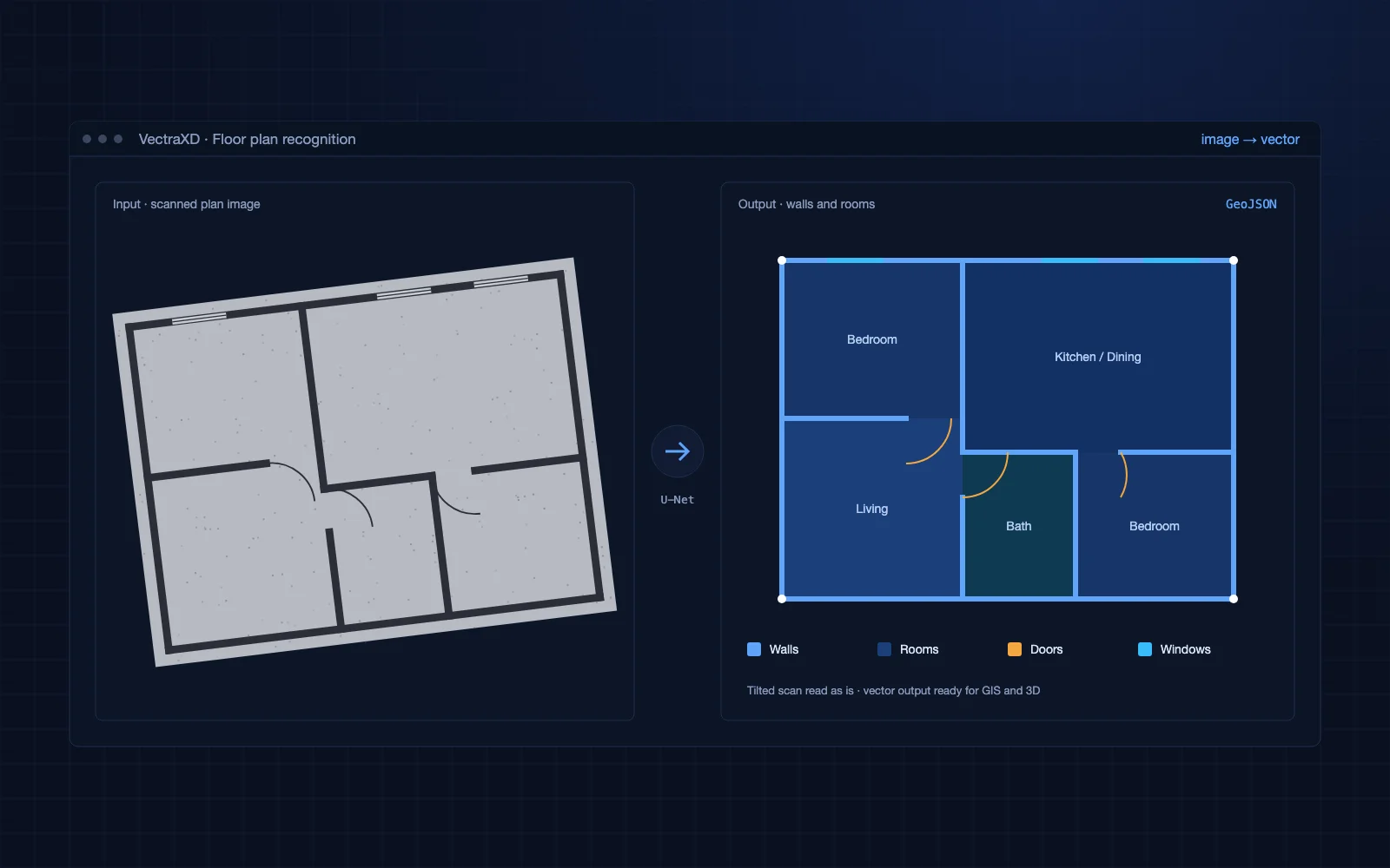
We built a web service that takes a floor plan image and returns its walls and rooms as vector data in GeoJSON. The deep learning model behind it was trained with stronger image backbones and with rotated plans, so it can also read plans that are scanned at an angle. On top of this, a pipeline cleans up the plan image with a generative AI model, traces the walls and extrudes them into a 3D model.
- A floor-plan-to-vector web service with GeoJSON output
- Recognition of walls, rooms and icons such as doors and windows
- Models trained to handle tilted and rotated plans
- A prototype that turns a plan image into a 3D wall model
Business impact
- Teams get walls and rooms as editable data instead of tracing plans by hand
- GeoJSON output goes straight into GIS and web map tools
- Tilted scans are read as they are, without manual straightening first
- The 3D prototype shows a path from a plan image to a simple building model