IDs that never match
Network, utility, parcel and BIM element IDs each follow their own scheme.

Digital twins · Spatial AI · CAD · GIS
Prolincur is a software development company. We build the 3D, CAD, GIS and AI software behind digital twins and the digital thread, for product companies and industrial firms in manufacturing, AEC, infrastructure, mining, telecom and energy.
A 30-minute call with an engineer, not a sales team. NDA on request.
Need a known capability fast? Try a fixed-price accelerator with a free sample file
Track record
The problem
Our software makes 3D, CAD, BIM, GIS and IoT data line up, so digital twins and AI agents can use it. Digital twins and AI agents fail on the same five gaps.
Network, utility, parcel and BIM element IDs each follow their own scheme.
BIM is exact, GIS is simplified, meshes look right but carry no meaning, scans are raw points.
Global, projected and project-local coordinate systems, often unknown or misaligned.
Models lack operational data, maps lack material and function, sensors lack precise location.
IoT readings rarely point to the exact asset, room or route they describe.
Solutions
Four solution areas, built on the same core: geometry, 3D, GIS and AI, in one senior software team. Your product may need one of them or several together.
CAD, BIM, scans and sensor data on the map, at scale.
Explore solutionAssets, sites and networks in 3D and on the map, live and ready to simulate.
Explore solutionAI that knows where things are, grounded in real geometry and maps.
Explore solutionDesign geometry used downstream, without a CAD seat.
Explore solutionOpen standards, no lock-in
Across the lifecycle
Industry runs as a loop: engineering feeds manufacturing, manufacturing feeds operations, and field data flows back into design. We build software wherever a stage needs geometry, 3D or location. We connect to your PLM, ERP, MES and IoT platforms; we do not replace them.
Requirements, CAD, CAE, BOM. Web CAD and BIM viewers, drawing conversion, geometry and meshing, simulation-ready geometry.
Process planning, plant layout, quality. 3D inspection and measurement, scan-to-model, configure-to-order tied to production data.
Field support, compliance, telemetry. Operational digital twins, 360 walkthroughs, rule checks and AI assistants over asset data.
Capabilities
The skills that are hardest to hire for, built into the product you already have. Each capability page goes into the technical depth.
Let your customers explore, configure and measure products in the browser, on any device.
Put large spatial datasets on the map and keep them fast, from a single site to a whole region.
Bring DWG, DXF and IFC data into your product, and connect design data to the real world.
Solve the modeling problems that off-the-shelf libraries cannot, on ACIS, OpenCascade or your own code.
Stream, clean and reconstruct multi-GB scans for the web and for CAD.
Connect 3D assets to live data, link them across systems, and simulate how they behave before decisions are made.
A 30-minute call with an engineer, not a sales pitch.
Industries
The same core skills, applied to very different products. Pick yours to see the problems we solve and the work behind them.
Process, tile and serve city-scale spatial data in the browser.
ExplorePlan networks against real terrain, buildings and signal coverage.
ExploreConnect 3D assets to the operational data behind them.
ExploreBring drawings and models into the tools your customers use every day.
ExploreCompare mine plans with actual progress, in 3D and over time.
ExploreInspect well and asset data in 3D, with measurement and reporting.
ExploreDesign geometry used in inspection, quality and configure-to-order, without a CAD seat.
ExploreTurn massive scans into meshes and models people can use.
ExplorePartners and programs
Built on open source such as three.js, CesiumJS and PostGIS. Autodesk Service Partner and Safe Software FME System Integrator for projects that need their platforms. Member of NVIDIA Inception and Microsoft for Startups Founders Hub. Read our Autodesk success story



Testimonials
We had some very advanced development requirements. Prolincur completed them successfully and on time… also added functionality that made the software even better than we envisioned.
Prolincur was responsive to feedback, quick at accomplishing tasks… knowledge of three.js, WebGL, and rendering was very thorough, and was able to fix bugs in a timely manner.
More client reviews on Clutch and DesignRush.
Featured case studies
Digital twins, spatial intelligence, spatial AI and smart manufacturing, from telecom and mining to oil & gas. Clients are described by type to respect confidentiality.
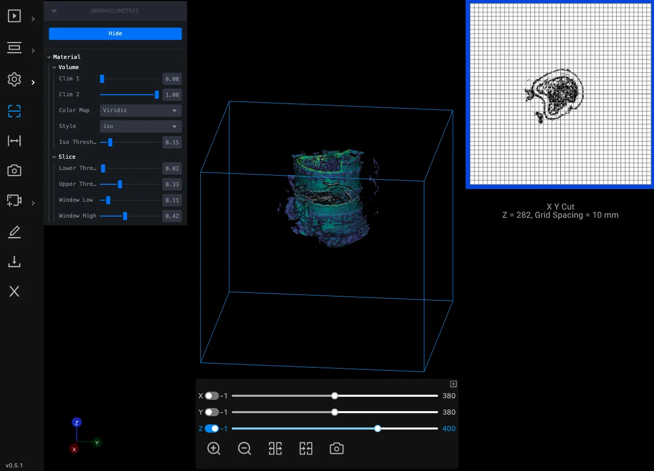
Oil & gas
A multi-year project: laser-scan volumetric data of wells inspected and measured in the browser, with reports and data management.
Read case study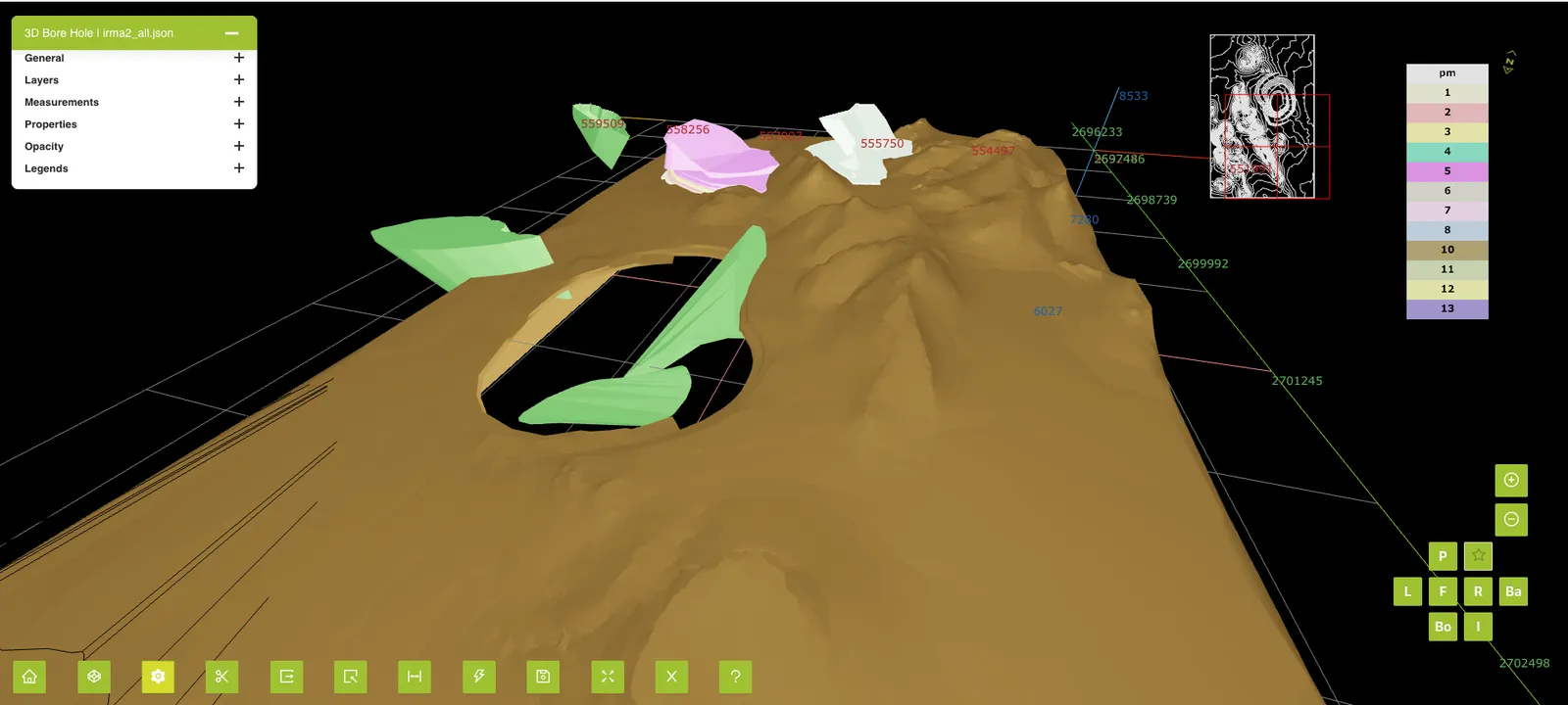
Mining
A browser-based 4D viewer that plays mine plans and actual progress back over time.
Read case study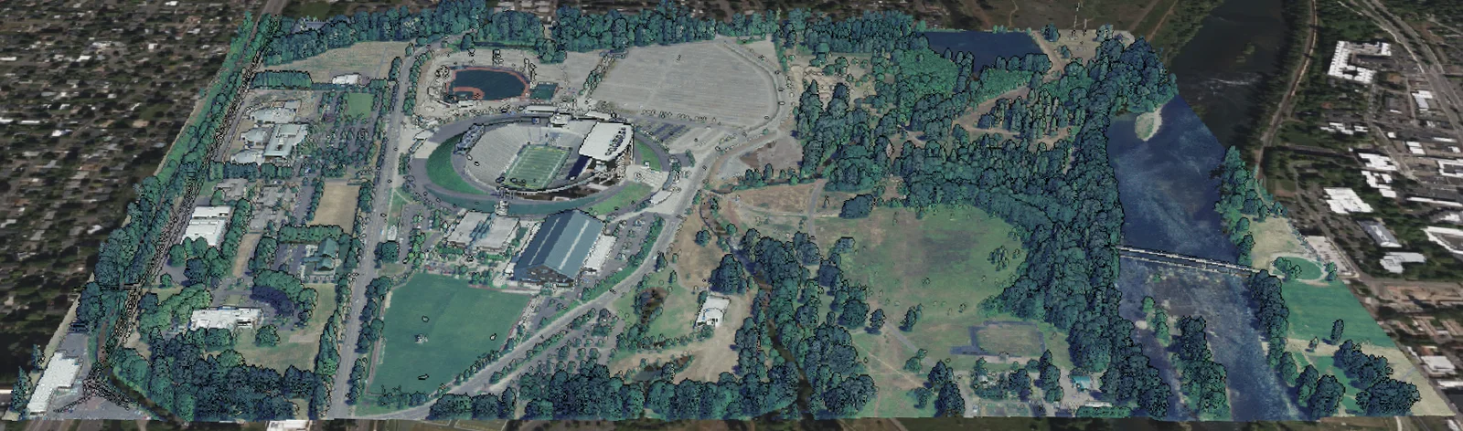
Reality capture / Survey
An automated 3D Tiles pipeline and streaming service that renders point clouds several GB in size in the browser.
Read case study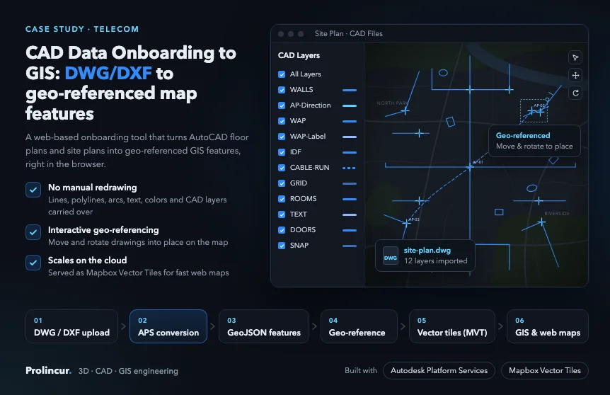
Telecom
AutoCAD DWG and DXF floor and site plans turned into geo-referenced map features with Autodesk Platform Services.
Read case study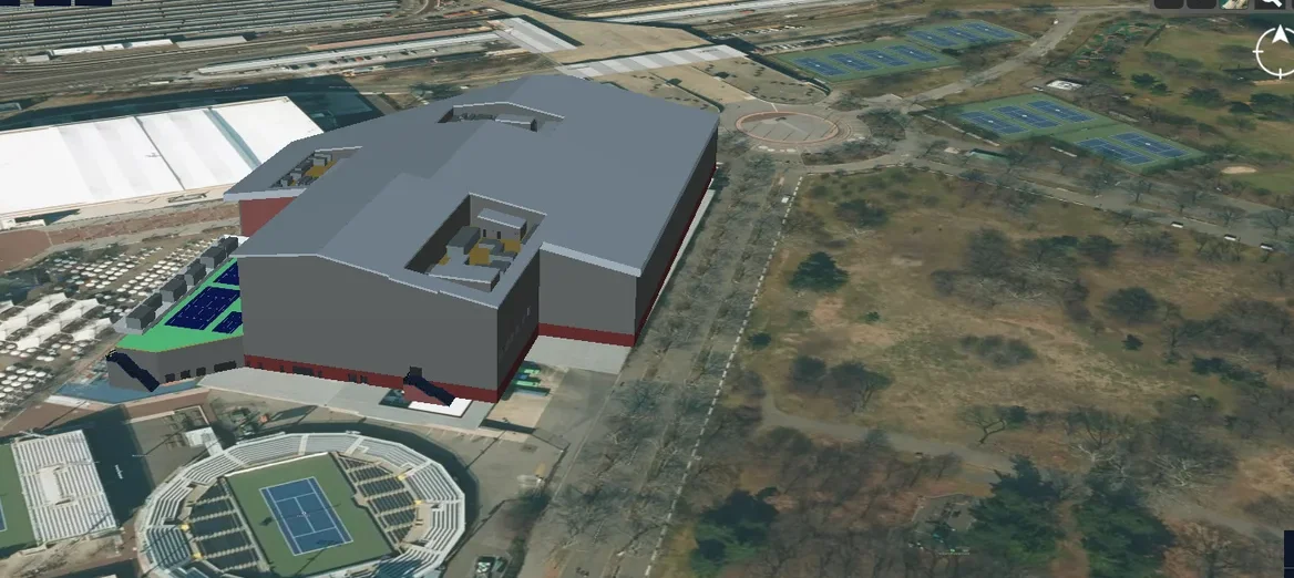
Telecom
An end-to-end platform to manage the physical and virtual assets of a 5G network in a 3D geospatial environment.
Read case study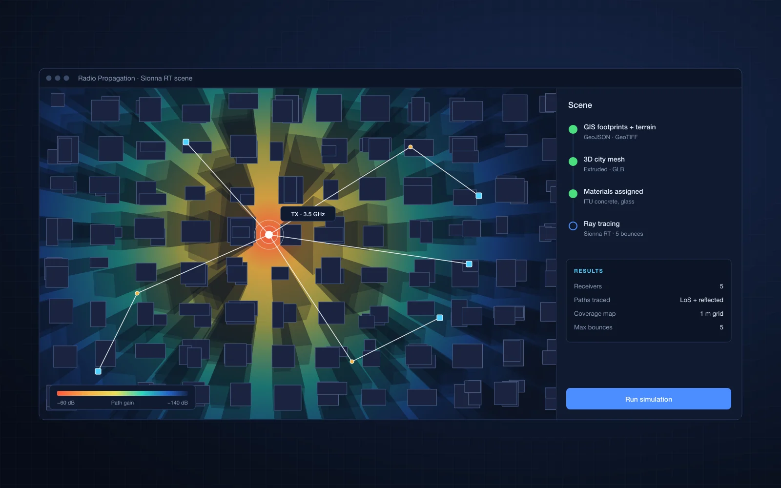
Telecom
3D city meshes generated from GIS data for physics-based radio propagation simulation with NVIDIA Sionna RT.
Read case studyWorking with us
A specialist software team for deep 3D, CAD, GIS and AI work, or a fixed-price accelerator when you need a known capability fast.
A specialist module team that extends your existing product.
Fixed-scope, fixed-price solutions built on proven components, delivered in weeks.
30 minutes with an engineer, under NDA if you need one.
1 to 3 weeks: requirements workshop, code and data review, and a proof of concept for the risky parts.
Phased plan, team, estimate and engagement model.
Two to three week iterations, with a demo every sprint.
Accelerators and platform
Fixed scope, fixed price, delivered in weeks. Built on our own components, so you start ahead, not from a blank page. Send a sample file first, free.
AutoCAD floor and site plans on your map
Revit and IFC models streamed in the browser
Scanned and PDF drawings turned into editable vectors
Point clouds and scans, streamed to the browser
A white-label viewer inside your product
Coming nextAI assistant for your GIS data (MCP) | Imagery to map features
Email your sample file to sales@prolincur.com. We return a link to the result, free, before you commit to anything. For files over 20 MB, email us first and we will send you a secure upload link.
Our 3D platform: translation, vectorization, reality processing and a viewer. The accelerators are built on it, so you start ahead, not from a blank page.
Open source
Some of the tools behind our projects, published for any engineering team to use.
three.js loader for OGC 3D Tiles (B3DM, glTF, GLB).
three.js loader for Gaussian splat scenes, streamed progressively.
Cross-platform DXF loader for three.js. Works out of the box with react-three-fiber.
Cross-platform E57 point cloud loader for three.js and react-three-fiber.
Start a conversation
We work on multi-phase engagements and long-term partnerships with product companies.