Coverage depends on the real world
Terrain and buildings shape signal propagation, but many planning tools flatten them.

We build 3D and geospatial software for network planning and tower management: radio coverage, propagation and assets, shown in their real-world context.
Proof
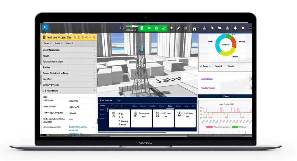
Telecom
A SaaS digital twin to monitor and manage telecom towers, site equipment and their performance in 3D, alongside operational data.
Read case study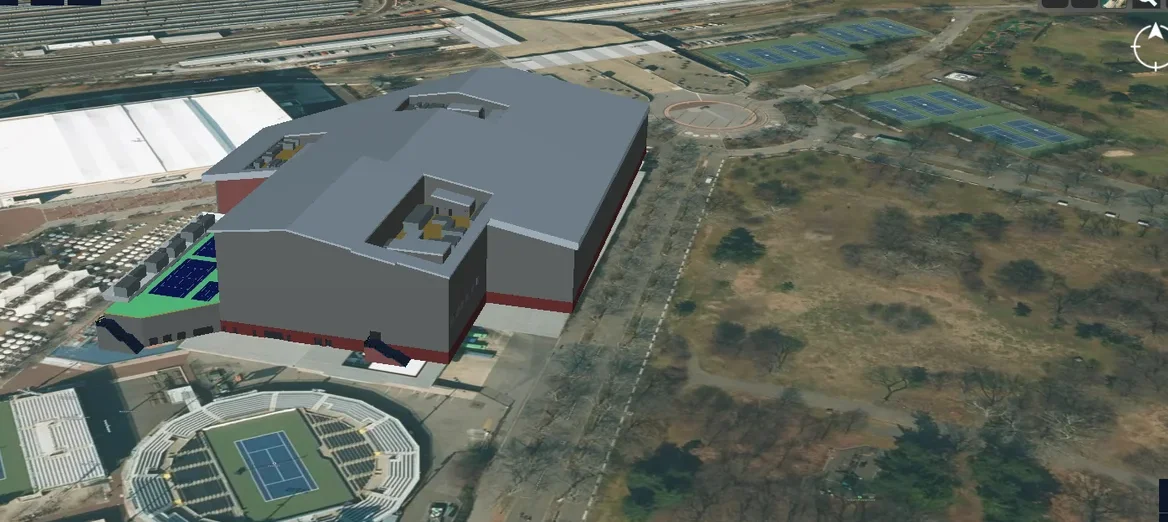
Telecom
An end-to-end platform to manage the physical and virtual assets of a 5G network in a 3D geospatial environment.
Read case study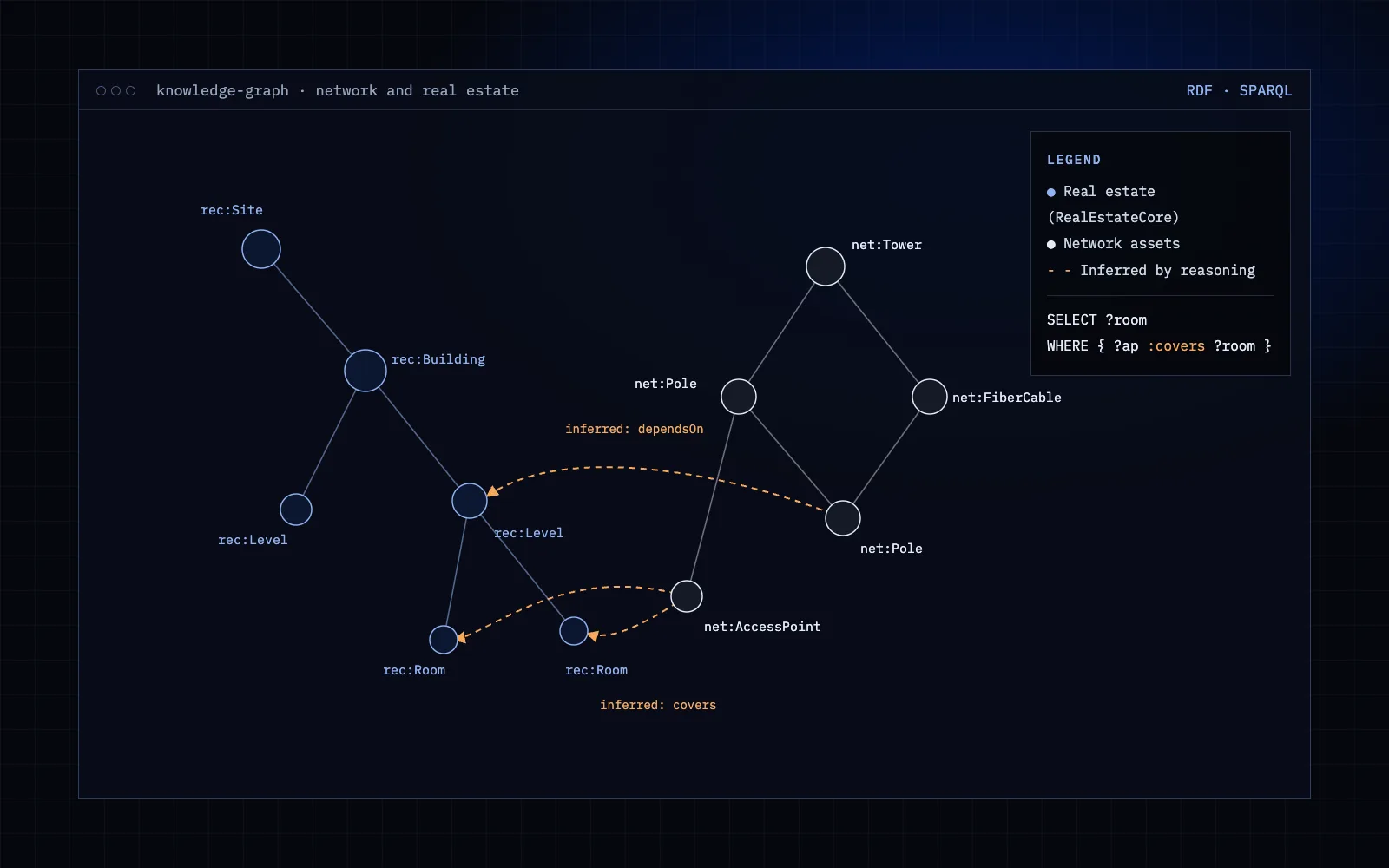
Telecom
A knowledge graph on AWS Neptune linking telecom network assets with the real estate they sit on, built on the RealEstateCore ontology with reasoning.
Read case studyChallenges we solve
Terrain and buildings shape signal propagation, but many planning tools flatten them.
Tower, equipment and performance data often lives in separate tools.
Raw radio maps and path data need clear visualization before they can drive decisions.
Site layouts arrive as DWG and DXF files that GIS tools cannot use directly.
What we build
Specialist modules that fit into your existing product, built by engineers who know this data.
Physics-based propagation with NVIDIA Sionna RT over real terrain, buildings, roads and bridges.
Digital twins, knowledge graphs and simulationTowers, equipment and performance data together in one 3D view.
Digital twins, knowledge graphs and simulationTerrain and buildings generated from GIS data, with shelled walls and assigned materials, ready for simulation.
Geometry and CAD kernel engineeringSite drawings converted into geo-referenced map features.
CAD, BIM and Autodesk APSCase studies
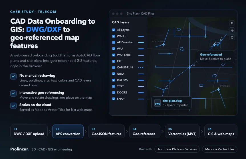
Telecom
AutoCAD DWG and DXF floor and site plans turned into geo-referenced map features with Autodesk Platform Services.
Read case study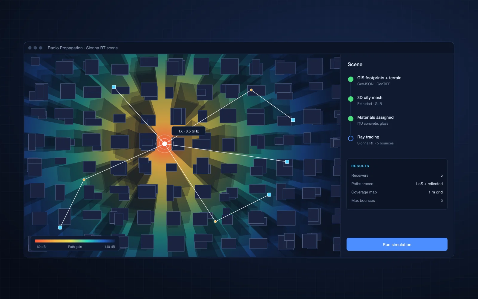
Telecom
3D city meshes generated from GIS data for physics-based radio propagation simulation with NVIDIA Sionna RT.
Read case studyData and technologies
FAQ
Yes. We can build visualization on top of your simulation output, or integrate engines such as NVIDIA Sionna RT.
Our radio propagation work runs on NVIDIA Sionna RT, which is built for 5G and 6G research, using 3D city meshes we generate from GIS data.
Yes. Most engagements start with one focused module, such as a coverage viewer or an asset view, inside your existing product.
Related industries
Tell us about the module you need. You will talk to an engineer from the first call.