Published as an Autodesk partner success story.
Business context
The client sells network planning software to telecom companies. Its customers already hold their site and floor data in AutoCAD drawings, but the platform works with geo-referenced GIS data. CAD drawings have no real-world coordinates, so this gap stood between new customers and their first useful plan.
The challenge
The client needed to bring floor plans and site plans from AutoCAD DWG and DXF files into their geospatial platform. Manual redrawing was slow and error-prone. Automating it meant reading a proprietary CAD format, keeping the layers and styles planners rely on, and placing each drawing at the right location and orientation on the map.
Our solution
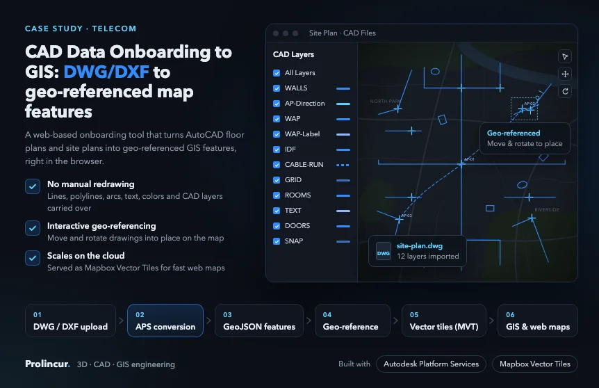
We built a web-based data onboarding tool with a cloud backend on Autodesk Platform Services. It reads DWG and DXF drawings and converts them into GeoJSON-compatible features. Users then geo-reference the drawing on the map. Output is served as Mapbox Vector Tiles (MVT), an open format any web map can use.
- DWG and DXF import through Autodesk Platform Services
- Lines, open and closed polylines, arcs and text converted to GeoJSON features
- CAD layers, colors and dashed line styles retained
- Interactive geo-referencing on the map, with move and rotate
- Output served as Mapbox Vector Tiles (MVT)
Business impact
Customers can bring the AutoCAD drawings they already have onto the map, with no re-survey or redrawing, and the geo-referenced geometry is ready for mapping, analysis and downstream workflows.
- Lower barrier to adoption: prospects start on the platform with data they already own
- Onboarding becomes a self-service step inside the product, not a manual GIS job
- Web-based, cloud-backed and tiled, so the client can onboard more sites without adding manual GIS work