Files your product cannot read
Design data arrives as DWG, DXF and IFC files that most web products cannot open.

We integrate DWG, DXF and IFC data into web products, build on Autodesk Platform Services, and put design data on the map.
Problems it solves
Design data arrives as DWG, DXF and IFC files that most web products cannot open.
Teams redraw or re-export drawings by hand to get data where it is needed.
Drawings use local coordinates, so they do not line up with GIS layers.
Embedding CAD viewing and processing well needs specialist platform knowledge.
What we deliver
Delivered as a module inside your existing product, in your codebase and with your team.
APS Viewer, Model Derivative and Design Automation built into your product.
Reading, extracting and converting drawing data for your application.
Drawings geo-referenced and converted into GIS features and vector tiles.
Automated processing, data extraction and checks across many files.
Case studies
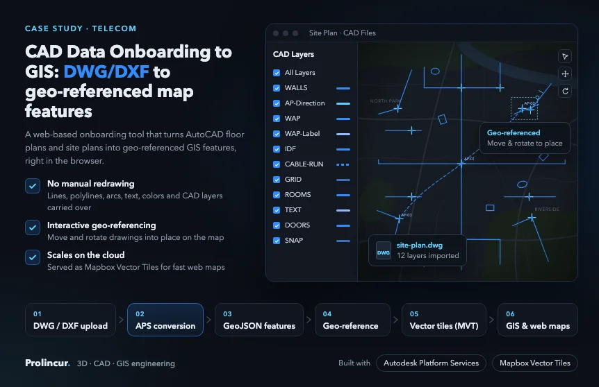
Telecom
AutoCAD DWG and DXF floor and site plans turned into geo-referenced map features with Autodesk Platform Services.
Read case study
GIS / Urban planning
Import, export and visualization of 3D building digital twins on a GIS map, inside an existing planning product.
Read case study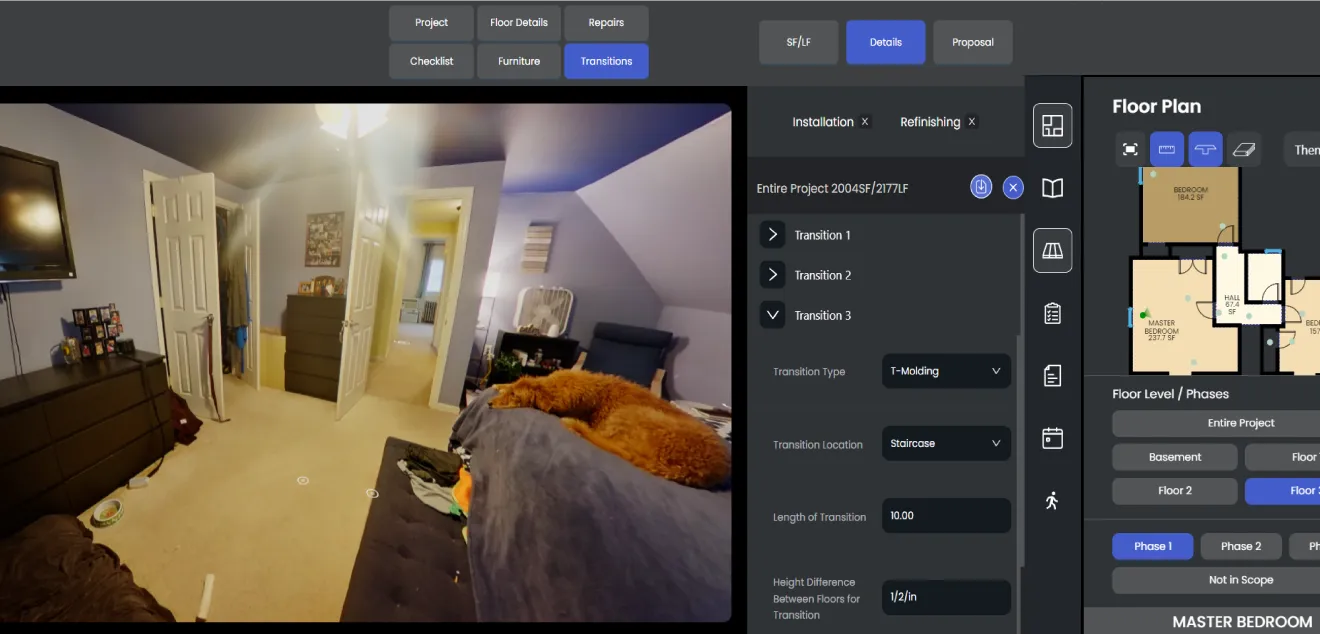
AEC / Construction
Customers preview renovation products in their own floor plan and 360° room panoramas, with pricing, scheduling and CRM built in.
Read case study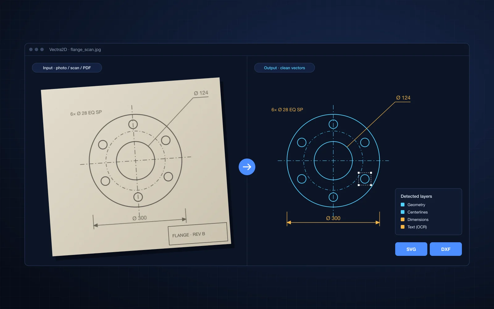
Manufacturing
The vectorization module of our VectraXD™ platform, a SaaS tool that converts photos, scans and PDFs of 2D engineering drawings into SVG and DXF.
Read case study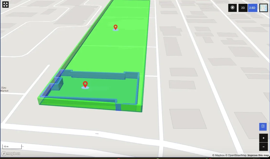
GIS / Urban planning
A Mapbox drawing and editing tool to create, import and manage custom real estate features on a map.
Read case studyTechnologies and formats
Industries
How we deliver
30 minutes with an engineer, under NDA if you need one.
1 to 3 weeks: requirements workshop, code and data review, and a proof of concept for the risky parts.
Phased plan, team, estimate and engagement model.
Two to three week iterations, with a demo every sprint.
FAQ
Yes. Prolincur is an Autodesk Service Partner, registered since January 2025.
No. We build custom software. We never sell licenses or training.
Yes. We geo-reference DWG and DXF data and convert it into GIS features and vector tiles.
See our Autodesk page at prolincur.com/autodesk for APS and AutoCAD work, accelerators and partner details.
Yes. Our CAD to Map and BIM to Web accelerators are fixed scope and fixed price, and start with a free sample file.
Tell us about the module you need. You will talk to an engineer from the first call.